|
This post showcase some beautiful pictures of
Pakistan. Islamic Republic of Pakistan is a country in South Asia. It is
the second largest Muslim population after Indonesia. The name Pakistan
means Land of (the) Pure in Urdu and Persian. Tourism is still a growing
industry in Pakistan because of its diverse cultures, people and
landscape. Pakistan also has five out of fourteen mountain peaks of
height over 8,000 metres (26,250 ft), that attract adventurers and
mountaineers from around the world, especially to K2. Lets take a trip
of Pakistan through some beautiful and amazing pictures. Hope you like
them.
|
|
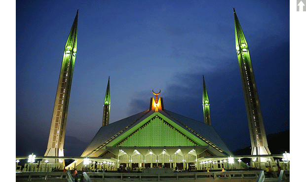
Faisal Mosque, Islamabad, Pakistan
The Shah Faisal Masjid in Islamabad, Pakistan - is among one of the
largest mosques in the world. Its Pakistan’s National Mosque. It is a
popular masjid in the Islamic world, and is renowned for both its size
and its architecture covering an area of 5,000 square meters with a
capacity of 300,000 worshippers. It’s relatively unusual design fuses
contemporary lines with the more traditional look of an Arab Bedouin's
tent, with its large triangular prayer hall and four minarets.
|
|
 |
|
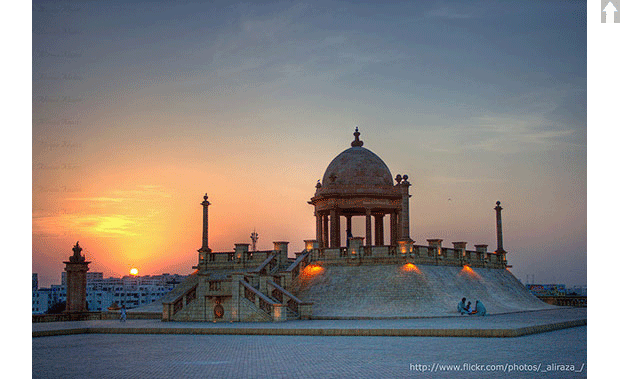
Jahangir Kothari, Karachi
Jehangir Kothari Parade is a promenade built on land bequeathed by Seth
Jehangir Hormusji Kothari to the city of Karachi . It is situated in the
Clifton area of the city - famous for its SeaView Beach - standing the
test of time for roughly 85 years to date. There are two structures; 1.
The Promenade Pavilion, 2) The Pier of the complex which is named after
Lady Lloyd, Governor of Bombay Sir George Lloyd's wife.[1] This is
evident in the marble plaque embedded in the pier wall that reads, "Lady
Lloyd Pier".
|
|
|
|
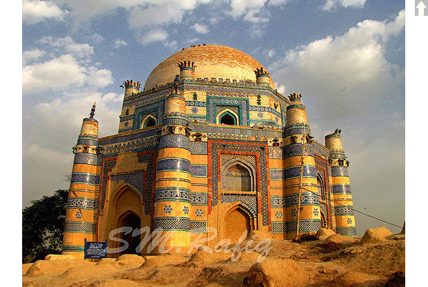
The Tomb of Jam Nido at Makli Hills, Thatta, Sindh,
Pakistan
This is the tomb of Jam Nido, a Summa ruler who reigned from
1461-1508.One of the largest necropolises in the world, with a diameter
of approximately 8 kilometers, Makli Hill is supposed to be the burial
place of some 125,000 Sufi saints. It is located on the outskirts of
Thatta, the capital of lower Sind until the seventeenth century, in what
is the southeastern province of present-day Pakistan.
|
|
|
|
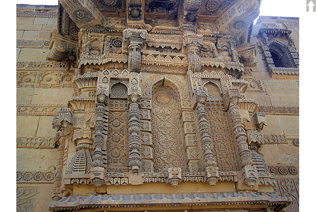
Shrine of Bibi Jawindi, Uch Sharif in Beautiful
Pictures of Pakistan
Uch or Uch Sharif is located in Punjab, Pakistan. Uch is also known as
"Alexandria at the Head of the Punjab", is a historical city in
Pakistan. Once it was an important city of ancient India. It is believed
that in 325 BC Alexander the Great founded a city called Alexandria at
the site of the last confluence of Punjab rivers with the Indus river.
|
|
|
|
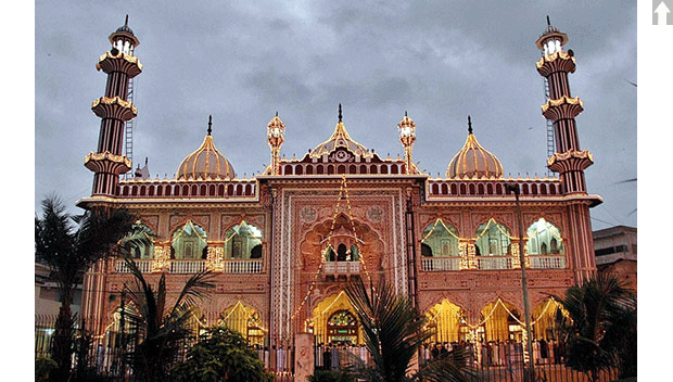
Arambagh Mosque, Karachi
An illuminated view of colorful lights installed over the Aram Bagh
Mosque in connection with Shab-e-Barat.
|
|
|
|
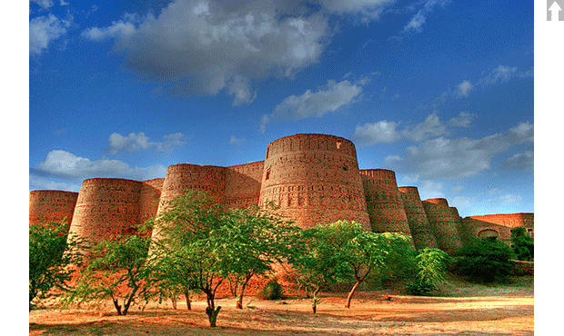
Derawar Fort, Cholistan, Pakistan
Derawar Fort is an ancient fort located in Cholistan Desert in Pakistan.
The Fort was built by Deoraj, a prince of Jaisalmer. It was in
possession of royal family of Jaisalmer when it was captured by Abbasis
in 1735. In 1747, the Fort slipped from the hands of Abbasis in the
reign of Nawab Bahawal Khan due to his pre-occupations at Shikarpur.
Nawab Mubarak Khan took the stronghold back in 1804.
|
|
 |
|
The Astore Valley in the Northern Areas of
Pakistan
Astore Valley (el. 2,600 m (8,500 ft)) is located in Astore District in
the Northern Areas of Pakistan. The valley, adjoining the eastern side
of mountain Nanga Parbat, is about 120 km (75 mi) long, having area of
5,092 km2 (1,966 sq mi).[citation needed]The entrance of the valley is
located about 60 km southeast of Gilgit with four side-valleys. The
valley has more than 100 villages with a total population of 71,666
(Census 1998)[citation needed], including Chilm, Bubin, Gorikot, Eid
Ghah, Fina, Bulen, Chongra and Tari Shing. Chilm is the most beautiful
village among all the villages of Astore, because it is the starting
point of Deosai, the world's second highest plateau. The majority of
people practice subsistence agriculture and livestock is the main source
of livelihood complemented by seasonal work in down districts of the
country. Due to its diverse landscape and climatic conditions the valley
provides excellent habitat for a variety of commercially important
medicinal plants.
|
|
 |
|
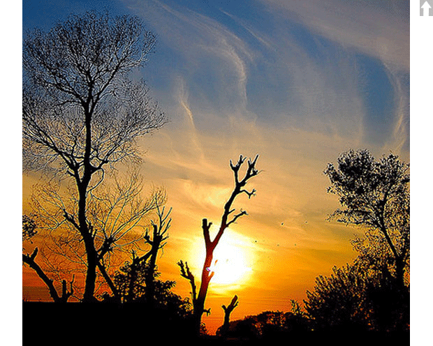
Sunset at GT Road, Pakistan
Even though it is Winter, sunset is still colorful and bright in
Pakistan.
|
|
 |
|
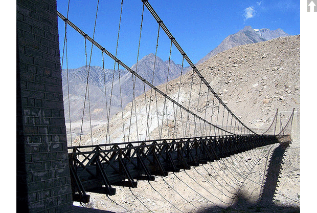
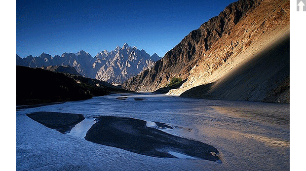
Beautiful Pakistan - View from Lord of the Rings
This is a view of Tupopdan mountain, one of the most amazing places
along Karakoram highway. The Karakoram is a ‘who’s who’ of the world’s
tallest peaks – including K-2, second only to Everest. And its valleys
deliver a glut of glaciers, the longest outside the polar regions, with
some creeping right to the road edge. The 240-kilometer Hunza Valley is
an ancient and remote kingdom in the northeast of Pakistan, nestled
close to China and the Wakhan Corridor of Afghanistan. The simplicity of
village life belies the valley’s strategic and economic importance. Not
so many years ago, travel through its narrow gorges and high passes was
treacherous as local brigands supplemented meagre agricultural outputs
by raiding silk route caravans, trading slaves and capturing loot.
|
|
 |
|
Pakistan - Fairy Meadows - Circles of Life
The mountain in the picture is Nanga parbat (also known as Nangaparbat
Peak or Diamir) is the 9th highest mountain on Earth and the 2nd highest
in Pakistan. Nanga Parbat has tremendous vertical relief over local
terrain in all directions. To the south, Nanga Parbat boasts what is
often referred to as the highest mountain face in the world: the Rupal
Face rises an incredible 4,600 m (15,000 feet) above its base. To the
north, the complex, somewhat more gently sloped Rakhiot Flank rises
7,000 m (22,966 feet) from the Indus River valley to the summit in just
27 km, one of the 10 greatest elevation gains in so short a distance on
Earth. Nanga Parbat is the fastest growing mountain on Earth and it is
still growing about 7mm a year.
|
|
 |